The Triangle, Barry Island
Introduction
The photograph on this page of The Triangle, Barry Island by Jaggery as part of the Geograph project.
The Geograph project started in 2005 with the aim of publishing, organising and preserving representative images for every square kilometre of Great Britain, Ireland and the Isle of Man.

There are currently over 7.5m images from over 14,400 individuals and you can help contribute to the project by visiting https://www.geograph.org.uk
The Triangle, Barry Island
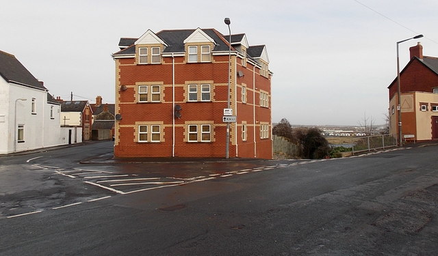
Image: © Jaggery Taken: 30 Dec 2012
This is part of the area known as The Triangle, at the junction of Clive Place on the left of the central (flats) building and Dock Road on the right side of the building. The road on the camera side is Plymouth Road on the left and Redbrink Crescent on the right.
Images are licensed for reuse under creativecommons.org/licenses/by-sa/2.0
Image Location
Latitude
51.394543
Longitude
-3.267529