Site of termination of Beckhole branch from Grosmont
Introduction
The photograph on this page of Site of termination of Beckhole branch from Grosmont by Ben Brooksbank as part of the Geograph project.
The Geograph project started in 2005 with the aim of publishing, organising and preserving representative images for every square kilometre of Great Britain, Ireland and the Isle of Man.

There are currently over 7.5m images from over 14,400 individuals and you can help contribute to the project by visiting https://www.geograph.org.uk
Site of termination of Beckhole branch from Grosmont
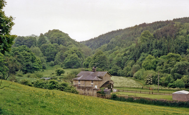
Image: © Ben Brooksbank Taken: 9 Jun 1988
View SW, to the end of the line, which had until 1865 been the upper end of an incline worked by horses from the Grosmont - Pickering section of the 1836 Whitby & Pickering Railway. In 1865 the NER built a four-mile deviation from Grosmont to replace this incline, but the stub, running to a proper station 'Beckhole', 200 yards further back (off this view), to which a passenger service was run in summer only, 1908-1914; goods was worked until 7/30, when floods demolished a bridge, although they continued for a short distance from Grosmont Branch Junction until 1952.
Images are licensed for reuse under creativecommons.org/licenses/by-sa/2.0
Image Location
Latitude
54.409357
Longitude
-0.736273