Beagles Row, Shute
Introduction
The photograph on this page of Beagles Row, Shute by Derek Harper as part of the Geograph project.
The Geograph project started in 2005 with the aim of publishing, organising and preserving representative images for every square kilometre of Great Britain, Ireland and the Isle of Man.

There are currently over 7.5m images from over 14,400 individuals and you can help contribute to the project by visiting https://www.geograph.org.uk
Beagles Row, Shute
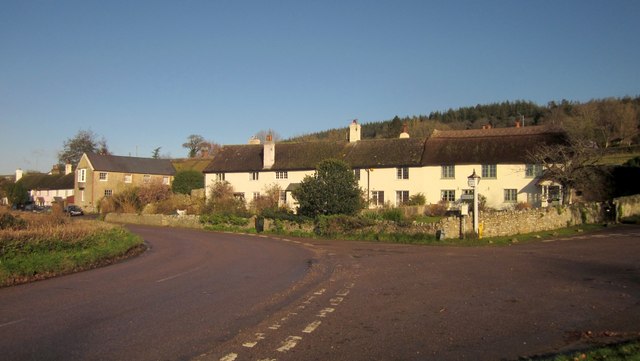
Image: © Derek Harper Taken: 5 Dec 2012
A clearer view of the terrace of cottages seen in Image] and described at http://list.english-heritage.org.uk/resultsingle.aspx?uid=1333615&searchtype=mapsearch . Just the right hand cottage is thatched. The prinicpal road swinging left here is from Seaton Junction to Taunton Cross on the A35. Leading off to the right at the broad junction are Ashes Road, a short lane leading to a route with public access, and Haddon Road, past the church. Both lead up the steep slopes of Shute Hill above the hamlet.
Images are licensed for reuse under creativecommons.org/licenses/by-sa/2.0
Image Location
Latitude
50.772869
Longitude
-3.062307