Bancroft Road
Introduction
The photograph on this page of Bancroft Road by Ian Capper as part of the Geograph project.
The Geograph project started in 2005 with the aim of publishing, organising and preserving representative images for every square kilometre of Great Britain, Ireland and the Isle of Man.

There are currently over 7.5m images from over 14,400 individuals and you can help contribute to the project by visiting https://www.geograph.org.uk
Bancroft Road
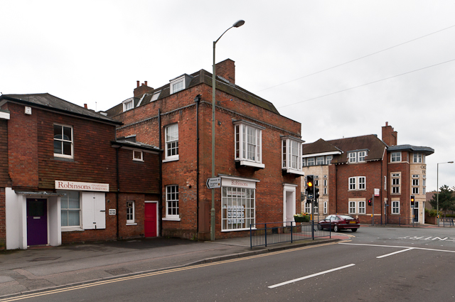
Image: © Ian Capper Taken: 8 Apr 2012
Bancroft Road at its junction with Bell Street. The building in the centre of the photo dates from the early/mid 18th century and is grade II listed - see www.historicengland.org.uk/listing/the-list/list-entry/1029131
Images are licensed for reuse under creativecommons.org/licenses/by-sa/2.0
Image Location
Latitude
51.236598
Longitude
-0.205037