Thornton Abbey chapterhouse from the east
Introduction
The photograph on this page of Thornton Abbey chapterhouse from the east by Paul Harrop as part of the Geograph project.
The Geograph project started in 2005 with the aim of publishing, organising and preserving representative images for every square kilometre of Great Britain, Ireland and the Isle of Man.

There are currently over 7.5m images from over 14,400 individuals and you can help contribute to the project by visiting https://www.geograph.org.uk
Thornton Abbey chapterhouse from the east
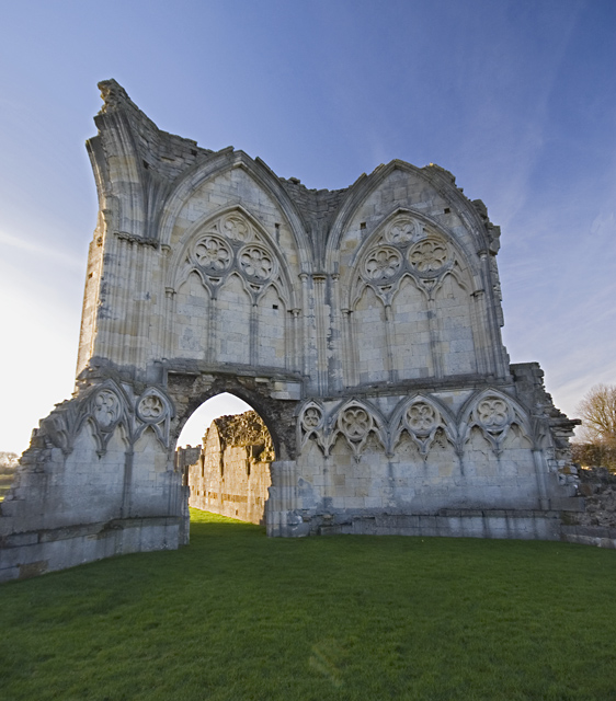
Image: © Paul Harrop Taken: 18 Nov 2012
The remains of the octagonal 13th century chapterhouse at the eastern end of the site. Thornton Abbey was founded as a priory in 1139 by William Le Gros and raised to an abbey in 1148. After its suppression in 1539, Henry VIII refounded it as a college of secular priests and a school for 14 boys, re-using the monastic buildings. This college was suppressed by Edward VI in 1547 and demolished by Sir Vincent Skinner in the years after 1602.
Images are licensed for reuse under creativecommons.org/licenses/by-sa/2.0
Image Location
Latitude
53.654842
Longitude
-0.309684