Dartford, DA1 - Railway Station Area
Introduction
The photograph on this page of Dartford, DA1 - Railway Station Area by David Hallam-Jones as part of the Geograph project.
The Geograph project started in 2005 with the aim of publishing, organising and preserving representative images for every square kilometre of Great Britain, Ireland and the Isle of Man.

There are currently over 7.5m images from over 14,400 individuals and you can help contribute to the project by visiting https://www.geograph.org.uk
Dartford, DA1 - Railway Station Area
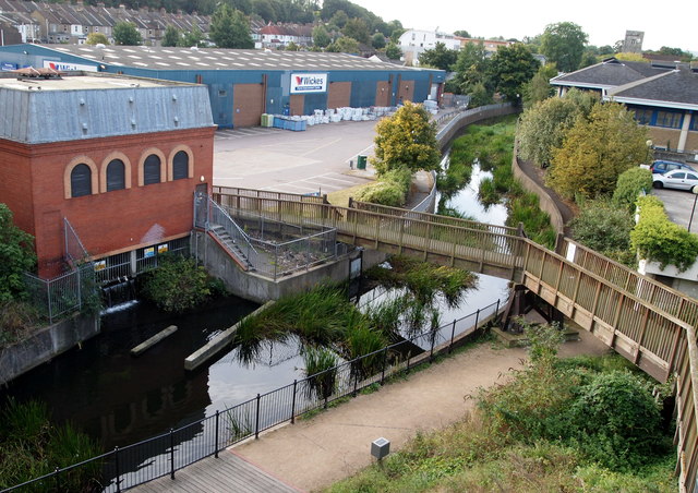
Image: © David Hallam-Jones Taken: 30 Sep 2012
This shot was taken from the top of a flight of steps that railway passengers use to cross between various platforms on Dartford Station. From here the interested observer is able to look down onto a section of the waymarked Darent Valley Path with a view towards Overy Street and Dartford Parish Church. This path is 19 miles (31 km) long and connects the River Thames with the Sevenoaks area. The wooden bridge however, carries pedestrians across the Darent to this small industrial estate.
Images are licensed for reuse under creativecommons.org/licenses/by-sa/2.0
Image Location
Latitude
51.446917
Longitude
0.22032