Well at Kerris
Introduction
The photograph on this page of Well at Kerris by Elizabeth Scott as part of the Geograph project.
The Geograph project started in 2005 with the aim of publishing, organising and preserving representative images for every square kilometre of Great Britain, Ireland and the Isle of Man.

There are currently over 7.5m images from over 14,400 individuals and you can help contribute to the project by visiting https://www.geograph.org.uk
Well at Kerris
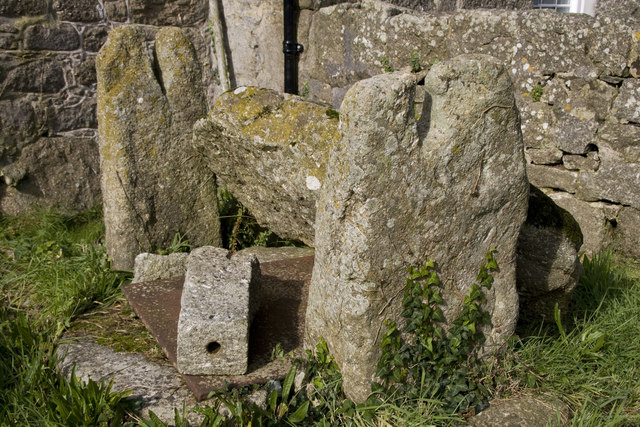
Image: © Elizabeth Scott Taken: 6 Oct 2012
The hole in the ground has been covered and a stone weighs down the cover. I assume that the two vertical pieces of granite with slots in the top would once have held a spindle mechanism to draw a bucket of water up. The fallen slab of granite at the back may once have been a cover for the whole thing.
Images are licensed for reuse under creativecommons.org/licenses/by-sa/2.0
Image Location
Latitude
50.089481
Longitude
-5.576313