Coventry Canal: Bridge Number 20A: Catgallow's Bridge
Introduction
The photograph on this page of Coventry Canal: Bridge Number 20A: Catgallow's Bridge by Nigel Cox as part of the Geograph project.
The Geograph project started in 2005 with the aim of publishing, organising and preserving representative images for every square kilometre of Great Britain, Ireland and the Isle of Man.

There are currently over 7.5m images from over 14,400 individuals and you can help contribute to the project by visiting https://www.geograph.org.uk
Coventry Canal: Bridge Number 20A: Catgallow's Bridge
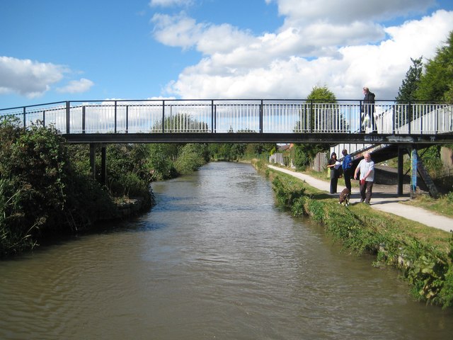
Image: © Nigel Cox Taken: 11 Sep 2012
From old large scale Ordnance Survey maps there was a canal crossing here called Catgallow's Bridge as early as 1889, when the surrounding land was just fields, and long before the houses on the east side and the allotments on the west side came. If this bridge did not exist people wishing to cross the canal would have to make lengthy detours as the next crossing to the north-west is Image some 700 metres away, and the next crossing to the south-east is Boot Bridge some 400 metres away. The photographer has no firm evidence that this is Bridge Number 20A, only that it falls between Bridge Numbers 20 and 21!
Images are licensed for reuse under creativecommons.org/licenses/by-sa/2.0
Image Location
Latitude
52.517343
Longitude
-1.475922