The clubhouse at Galashiels Golf Course
Introduction
The photograph on this page of The clubhouse at Galashiels Golf Course by Walter Baxter as part of the Geograph project.
The Geograph project started in 2005 with the aim of publishing, organising and preserving representative images for every square kilometre of Great Britain, Ireland and the Isle of Man.

There are currently over 7.5m images from over 14,400 individuals and you can help contribute to the project by visiting https://www.geograph.org.uk
The clubhouse at Galashiels Golf Course
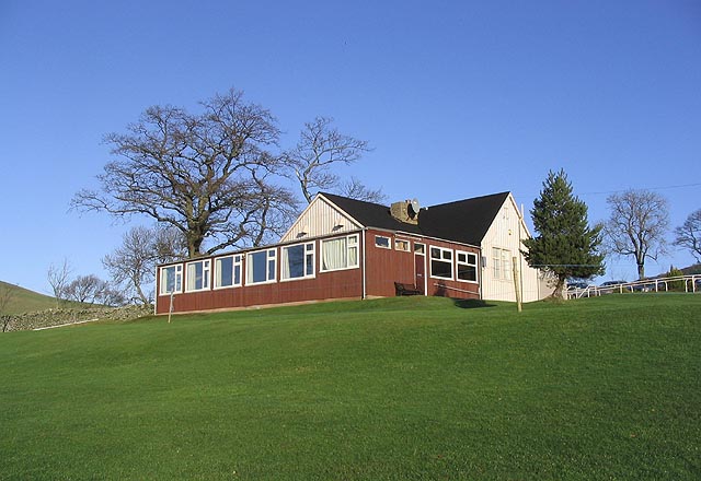
Image: © Walter Baxter Taken: 16 Jan 2007
The clubhouse enjoys a prominent position overlooking the town from the west slopes of Blaikie's Hill. The land that the golf course and clubhouse occupy, known as Ladhope Recreation Ground, was donated to the people of Galashiels in 1912 by Mr Hugh Roberts. The first golf club was founded in 1884, disbanded in 1897 and reformed in 1912. The 18 hole course was designed by James Braid. The present clubhouse was upgraded and extended in the late 1960's and within recent years, has been extended to the rear to upgrade the changing room facilities. (Source: "Galashiels - A Modern History").
Images are licensed for reuse under creativecommons.org/licenses/by-sa/2.0
Image Location
Latitude
55.620792
Longitude
-2.804378