Lass o' Gowrie
Introduction
The photograph on this page of Lass o' Gowrie by Gerald England as part of the Geograph project.
The Geograph project started in 2005 with the aim of publishing, organising and preserving representative images for every square kilometre of Great Britain, Ireland and the Isle of Man.

There are currently over 7.5m images from over 14,400 individuals and you can help contribute to the project by visiting https://www.geograph.org.uk
Lass o' Gowrie
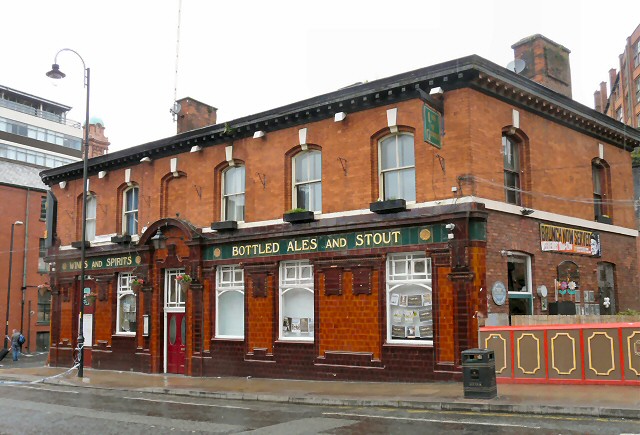
Image: © Gerald England Taken: 2 Jul 2012
Busy pub on Charles Street by the side of the Medlock Image According to a now defunct website - In the late 1800s, this part of Manchester was known as "Little Ireland", due in the main to the large numbers of Irish immigrant workers living there. However, the area was also home to extreme poverty and terrible hardship and quickly came to be synonymous with all the evils and squalor of unregulated industrialisation for Manchester had by then became notorious for. It was in this charnel house of blood, sweat tears and tragedy that the pub we today know as the Lass O' Gowrie was born. Legend has it that the original landlord of the pub was not an Irishman, but a proud, homesick Scotsman who named the pub in honour of his favourite poem - 'the Lass O'Gowrie' written by the celebrated Scottish poet Lady Carolina Nairne Image On the side of the pub a plaque states Image Here was the site of Manchester's oldest Pissotier, last used A.D.1896
Images are licensed for reuse under creativecommons.org/licenses/by-sa/2.0
Image Location
Latitude
53.474083
Longitude
-2.237853