Nantyffyllon Institute viewed from the SW
Introduction
The photograph on this page of Nantyffyllon Institute viewed from the SW by Jaggery as part of the Geograph project.
The Geograph project started in 2005 with the aim of publishing, organising and preserving representative images for every square kilometre of Great Britain, Ireland and the Isle of Man.

There are currently over 7.5m images from over 14,400 individuals and you can help contribute to the project by visiting https://www.geograph.org.uk
Nantyffyllon Institute viewed from the SW
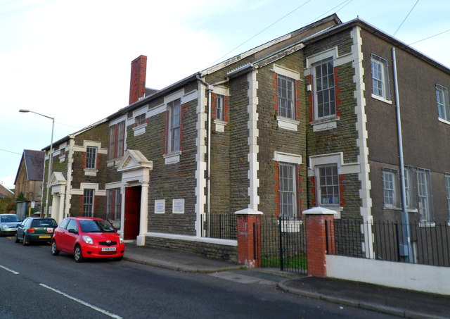
Image: © Jaggery Taken: 17 Nov 2011
Also referred to as Norths Memorial Hall. An inscription in stone on the building shows NANTYFFYLLON WORKMENS INSTITUTE 1926. There are several foundation stones, two of which can be seen on the right side of the doorway, showing the date August 22nd 1925. Facilities available include a gym, concert rooms, a games room, meeting/training rooms, a creche and kitchen. Activities and groups using the institute include religious meetings and Sunday School, Welsh Education Authority, a youth club, keep fit, an advice & information centre, Mothers and Toddlers group, bingo club and dog training classes.
Images are licensed for reuse under creativecommons.org/licenses/by-sa/2.0
Image Location
Latitude
51.619558
Longitude
-3.661063