Lowestoft Ness and the Euroscope
Introduction
The photograph on this page of Lowestoft Ness and the Euroscope by Roger Jones as part of the Geograph project.
The Geograph project started in 2005 with the aim of publishing, organising and preserving representative images for every square kilometre of Great Britain, Ireland and the Isle of Man.

There are currently over 7.5m images from over 14,400 individuals and you can help contribute to the project by visiting https://www.geograph.org.uk
Lowestoft Ness and the Euroscope
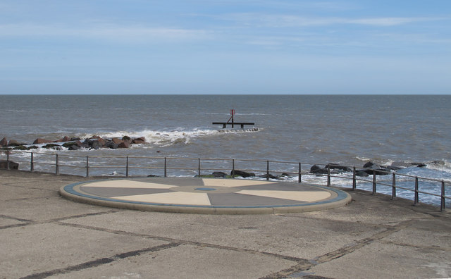
Image: © Roger Jones Taken: 5 Jun 2012
This is Ness Point at Lowestoft, with a view of the Euroscope which marks the most easterly part of the British Isles (and of course Suffolk). You can also see a couple of groynes (breakwaters) which extend a little further east, but as the tide is relatively high, they are partially covered by the North Sea. The Euroscope shows the distances to places in Europe and the UK. Chris Downer's photo http://www.geograph.org.uk/photo/1602696 gives a good close up view. For more info on Ness Point see http://www.ness-point.co.uk/
Images are licensed for reuse under creativecommons.org/licenses/by-sa/2.0
Image Location
Latitude
52.481129
Longitude
1.762697