Llwyncelyn
Introduction
The photograph on this page of Llwyncelyn by Philip Halling as part of the Geograph project.
The Geograph project started in 2005 with the aim of publishing, organising and preserving representative images for every square kilometre of Great Britain, Ireland and the Isle of Man.

There are currently over 7.5m images from over 14,400 individuals and you can help contribute to the project by visiting https://www.geograph.org.uk
Llwyncelyn
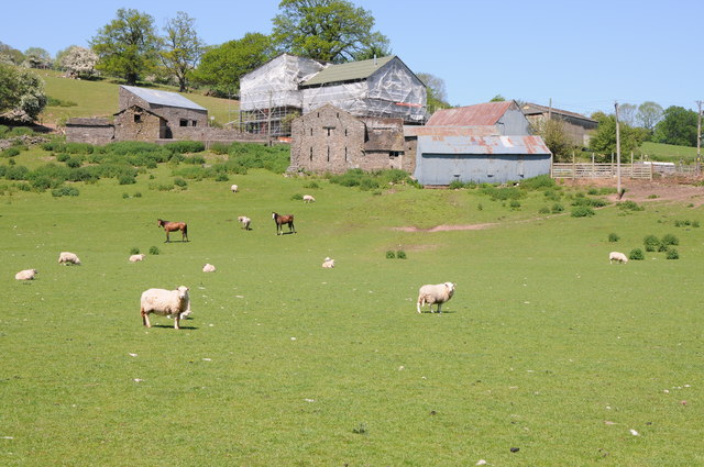
Image: © Philip Halling Taken: 26 May 2012
I have photographed this farm just off the Vale of Ewyas before and each time part of it is shrowded from view. Pevsner describes it as 'a fine farm group as seen from the south, the gable-end of a barn below, the farmhouse above.' He also states that 'the house is something quite exceptional, a complete late medieval hall house, with a parlour wing, all of stone.'
Images are licensed for reuse under creativecommons.org/licenses/by-sa/2.0
Image Location
Latitude
51.89037
Longitude
-3.004613