The Lower Red Lion
Introduction
The photograph on this page of The Lower Red Lion by Ian Capper as part of the Geograph project.
The Geograph project started in 2005 with the aim of publishing, organising and preserving representative images for every square kilometre of Great Britain, Ireland and the Isle of Man.

There are currently over 7.5m images from over 14,400 individuals and you can help contribute to the project by visiting https://www.geograph.org.uk
The Lower Red Lion
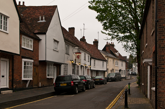
Image: © Ian Capper Taken: 3 May 2012
17th century pub on Fishpool Street, once part of the main route from London to the northwest. Grade II listed - see www.historicengland.org.uk/listing/the-list/list-entry/1103142. The buildings beyond are also grade II listed - nos 32 and 30 (with the overhanging first floor), 16th century - see www.historicengland.org.uk/listing/the-list/list-entry/1172805, no 28 (with low pitched slate roof), early 19th century - see www.historicengland.org.uk/listing/the-list/list-entry/1347126 and no 26 (with dormer window in the roof), early 17th century - see www.historicengland.org.uk/listing/the-list/list-entry/1103140.
Images are licensed for reuse under creativecommons.org/licenses/by-sa/2.0
Image Location
Latitude
51.751631
Longitude
-0.346547