
Stromness, The Mainland Orkney
Introduction
The photograph on this page of Stromness, The Mainland Orkney by Wolfgang Schlick as part of the Geograph project.
The Geograph project started in 2005 with the aim of publishing, organising and preserving representative images for every square kilometre of Great Britain, Ireland and the Isle of Man.

There are currently over 7.5m images from over 14,400 individuals and you can help contribute to the project by visiting https://www.geograph.org.uk
Stromness, The Mainland Orkney
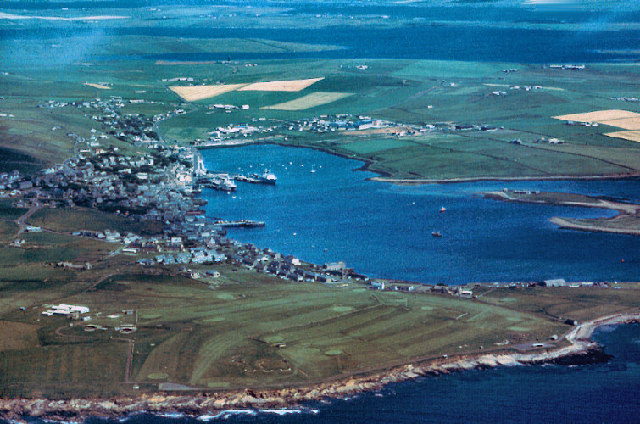
Image: © Wolfgang Schlick Taken: Unknown
Pic shows the situation in July 1991 (date is a guess +/- a couple of days). Taken from D-EEZZ on the way from Kirkwall to Sumburgh. The boat on the portside of Stromness Ferry Pier is a Russian Research Vessel. Grid reference is given for the town centre. View ranges from Warbeth Beach (bottom) over Hamnavoe to the Lochs of Harray and Stennes (top).
Images are licensed for reuse under creativecommons.org/licenses/by-sa/2.0
Image Location

Latitude
58.966168
Longitude
-3.297205