Murray Street, Belfast
Introduction
The photograph on this page of Murray Street, Belfast by Albert Bridge as part of the Geograph project.
The Geograph project started in 2005 with the aim of publishing, organising and preserving representative images for every square kilometre of Great Britain, Ireland and the Isle of Man.

There are currently over 7.5m images from over 14,400 individuals and you can help contribute to the project by visiting https://www.geograph.org.uk
Murray Street, Belfast
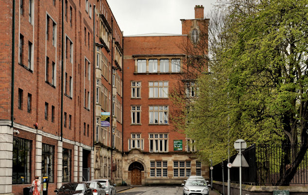
Image: © Albert Bridge Taken: 22 Apr 2012
Murray Street, off Fisherwick Place (College Square East on the Google map), between Jury’s (left) and the grounds of Inst Image (right) seems to have been built as Murray’s Terrace between 1844 and 1851 as a mixed commercial and residential street. This building Image (1910) is in the background. The 1910 street directory records that the site had been cleared in preparation for its construction. An interesting glimpse into Edwardian Belfast is that no1 was The Standard Governess and Scholastic Agency – Miss RA Murray, teacher of music and singing.
Images are licensed for reuse under creativecommons.org/licenses/by-sa/2.0
Image Location
Latitude
54.596342
Longitude
-5.935848