Spruisty Bridge, Knox
Introduction
The photograph on this page of Spruisty Bridge, Knox by Derek Harper as part of the Geograph project.
The Geograph project started in 2005 with the aim of publishing, organising and preserving representative images for every square kilometre of Great Britain, Ireland and the Isle of Man.

There are currently over 7.5m images from over 14,400 individuals and you can help contribute to the project by visiting https://www.geograph.org.uk
Spruisty Bridge, Knox
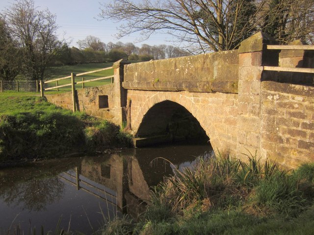
Image: © Derek Harper Taken: 1 Apr 2012
Another view of the listed bridge (downstream side) shown in http://www.geograph.org.uk/search.php?i=30145184 . As the Oak Beck is a parish boundary, the bridge is described twice, at http://www.britishlistedbuildings.co.uk/en-329888-spruisty-bridge-harrogate and http://www.britishlistedbuildings.co.uk/en-331539-spruisty-packhorse-bridge-over-oak-beck- ; the former doesn't seem to consider it C17.
Images are licensed for reuse under creativecommons.org/licenses/by-sa/2.0
Image Location
Latitude
54.014925
Longitude
-1.551758