The top of Billinge Avenue and St Silas
Introduction
The photograph on this page of The top of Billinge Avenue and St Silas by Bill Boaden as part of the Geograph project.
The Geograph project started in 2005 with the aim of publishing, organising and preserving representative images for every square kilometre of Great Britain, Ireland and the Isle of Man.

There are currently over 7.5m images from over 14,400 individuals and you can help contribute to the project by visiting https://www.geograph.org.uk
The top of Billinge Avenue and St Silas
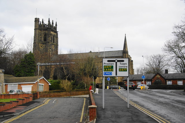
Image: © Bill Boaden Taken: 17 Mar 2012
At the top is the main road from Blackburn towards Preston. The church of St Silas is a major landmark.
Images are licensed for reuse under creativecommons.org/licenses/by-sa/2.0
Image Location
Latitude
53.751252
Longitude
-2.507383