90 Reigate Hill
Introduction
The photograph on this page of 90 Reigate Hill by Ian Capper as part of the Geograph project.
The Geograph project started in 2005 with the aim of publishing, organising and preserving representative images for every square kilometre of Great Britain, Ireland and the Isle of Man.

There are currently over 7.5m images from over 14,400 individuals and you can help contribute to the project by visiting https://www.geograph.org.uk
90 Reigate Hill
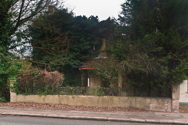
Image: © Ian Capper Taken: 21 Jan 2012
This house suffered fire damage a few years ago and has been left as ruin ever since, now so overgrown that it is hardly visible. Despite its position on a busy main road, it's surprising that it hasn't yet been redeveloped. The 1896 map suggests it was once a post office.
Images are licensed for reuse under creativecommons.org/licenses/by-sa/2.0
Image Location
Latitude
51.250617
Longitude
-0.201482