Winsford Avenue
Introduction
The photograph on this page of Winsford Avenue by E Gammie as part of the Geograph project.
The Geograph project started in 2005 with the aim of publishing, organising and preserving representative images for every square kilometre of Great Britain, Ireland and the Isle of Man.

There are currently over 7.5m images from over 14,400 individuals and you can help contribute to the project by visiting https://www.geograph.org.uk
Winsford Avenue
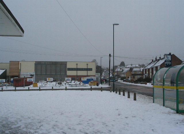
Image: © E Gammie Taken: 5 Feb 2012
The junction of Whitaker Road (left) with Winsford Avenue after an overnight snowfall of 8-10cm. Main roads have been gritted and the bus has successfully negotiated both up and back down Winsford Avenue. The block on the far side of Whitaker Road is phase 1 of the Allesley Park neighbourhood centre which opened in 2011. The new centre currently houses a library, replacing a mobile service, and a medical centre, moved from the block which stood at the corner and was recently demolished, hence the rubble at the corner. A similar view in worse snow in 1990 shows the former medical centre: http://www.geograph.org.uk/photo/1073466 . Street lighting and bus stops have also altered in the intervening years.
Images are licensed for reuse under creativecommons.org/licenses/by-sa/2.0
Image Location
Latitude
52.413296
Longitude
-1.555958