Llwynypia railway station
Introduction
The photograph on this page of Llwynypia railway station by Jaggery as part of the Geograph project.
The Geograph project started in 2005 with the aim of publishing, organising and preserving representative images for every square kilometre of Great Britain, Ireland and the Isle of Man.

There are currently over 7.5m images from over 14,400 individuals and you can help contribute to the project by visiting https://www.geograph.org.uk
Llwynypia railway station
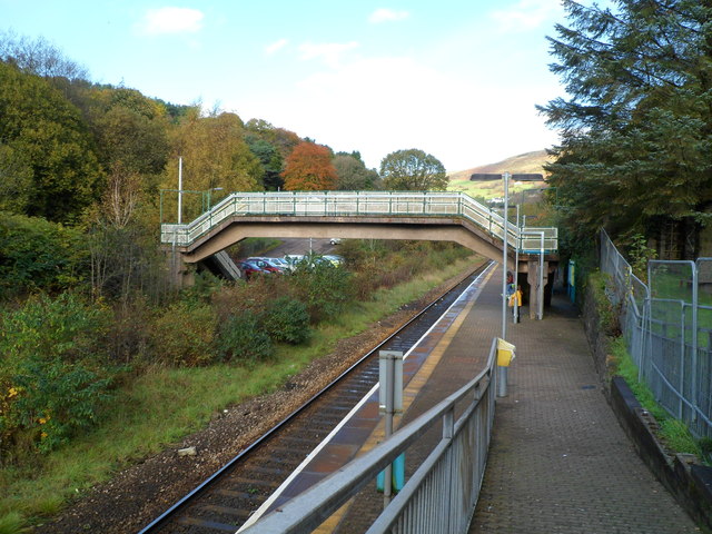
Image: © Jaggery Taken: 28 Oct 2011
Viewed down the access ramp from the A4058. Llwynypia station is on the Rhondda Line, between Tonypandy station to the south and Ystrad Rhondda station to the north. The footbridge leads to the station's car park (capacity 12 vehicles).
Images are licensed for reuse under creativecommons.org/licenses/by-sa/2.0
Image Location
Latitude
51.633102
Longitude
-3.453485