A Drumlin near Crosshill
Introduction
The photograph on this page of A Drumlin near Crosshill by Mary and Angus Hogg as part of the Geograph project.
The Geograph project started in 2005 with the aim of publishing, organising and preserving representative images for every square kilometre of Great Britain, Ireland and the Isle of Man.

There are currently over 7.5m images from over 14,400 individuals and you can help contribute to the project by visiting https://www.geograph.org.uk
A Drumlin near Crosshill
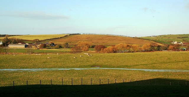
Image: © Mary and Angus Hogg Taken: 5 Jan 2012
South Ayrshire's farmland has been shaped by glacial deposits from the last Ice Age, typically from low rolling mounds called drumlins. This one, between Dalduff and Garpin Farms in the Girvan Valley, shows the classic drumlin shape. The field boundaries lie along the crest, while the road between Maybole and Crosshill follows a lower line, next to Garpin Farm. Viewed from outside the square, near Kileekie Farm, with very wet ground conditions.
Images are licensed for reuse under creativecommons.org/licenses/by-sa/2.0
Image Location
Latitude
55.33137
Longitude
-4.647913