Perimeter wall of the former Crymlyn Burrows Chemical Works
Introduction
The photograph on this page of Perimeter wall of the former Crymlyn Burrows Chemical Works by vectorkraft as part of the Geograph project.
The Geograph project started in 2005 with the aim of publishing, organising and preserving representative images for every square kilometre of Great Britain, Ireland and the Isle of Man.

There are currently over 7.5m images from over 14,400 individuals and you can help contribute to the project by visiting https://www.geograph.org.uk
Perimeter wall of the former Crymlyn Burrows Chemical Works
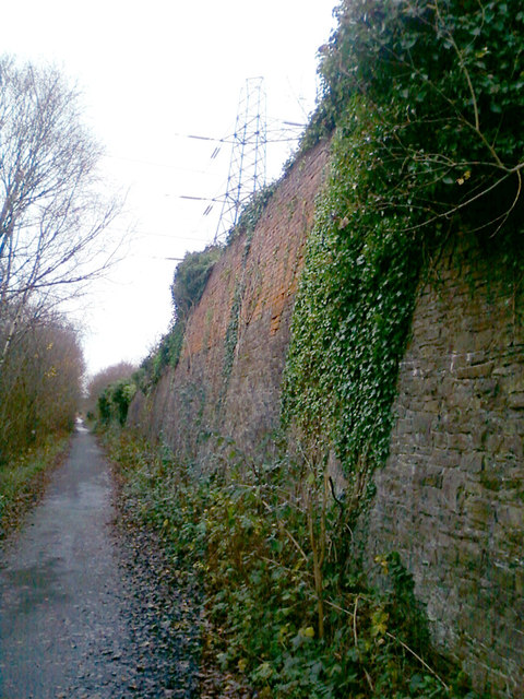
Image: © vectorkraft Taken: 5 Dec 2011
The view was taken from the canal path of the Tennant Canal, Port Tennant. Crymlyn Burrows Chemical Works (sometimes referred to Pritchard's Chemical Works) opened in the late 19th Century and was owned and operated by J.D. Pritchard (and partners). Oxalic Acid was one of its products. The works complex featured an internal narrow gauge railway, various peripheral outbuildings and a large sandpit. Goods were moved to and from the works by canal and rail. Workers lived at Pritchard's Cottages next to the complex. The works under his ownership closed in December 1911 (reference: London Gazette, 15 November 1912 p8407). The photograph shows the last remaining outer wall from this plant. An aerial photograph from 1949 shows significant demolition had taken place by this time, although this isn't thought to be as a result of World War II.
Images are licensed for reuse under creativecommons.org/licenses/by-sa/2.0
Image Location
Latitude
51.624041
Longitude
-3.8879