St Peter's kirkyard, Peterhead
Introduction
The photograph on this page of St Peter's kirkyard, Peterhead by Martyn Gorman as part of the Geograph project.
The Geograph project started in 2005 with the aim of publishing, organising and preserving representative images for every square kilometre of Great Britain, Ireland and the Isle of Man.

There are currently over 7.5m images from over 14,400 individuals and you can help contribute to the project by visiting https://www.geograph.org.uk
St Peter's kirkyard, Peterhead
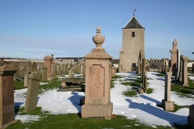
Image: © Martyn Gorman Taken: 4 Nov 2006
The gravestone in the middle foreground is the family grave of the Grays, a dynasty of whaling captains who travelled to Greenland waters in the 19th century. The tower in the background is part of the old church of St Peter. It was used in the early 1800s as a look out by men guarding the cemetery against grave robbers in search of fresh corpses for the Aberdeen anatomy schools.
Images are licensed for reuse under creativecommons.org/licenses/by-sa/2.0
Image Location
Latitude
57.50403
Longitude
-1.791395