Centaur Street
Introduction
The photograph on this page of Centaur Street by Martin Addison as part of the Geograph project.
The Geograph project started in 2005 with the aim of publishing, organising and preserving representative images for every square kilometre of Great Britain, Ireland and the Isle of Man.

There are currently over 7.5m images from over 14,400 individuals and you can help contribute to the project by visiting https://www.geograph.org.uk
Centaur Street
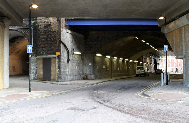
Image: © Martin Addison Taken: 2 Dec 2011
Seen from the junction with Carlisle Lane. The closest flat span bridge carries the European Terminal tracks whilst beyond the blue girder, the spans carry the tracks into Waterloo Station.
Images are licensed for reuse under creativecommons.org/licenses/by-sa/2.0
Image Location


Leaflet Map data © OpenStreetMap
Latitude
51.498103
Longitude
-0.114476