The White House, Stockley Park
Introduction
The photograph on this page of The White House, Stockley Park by Des Blenkinsopp as part of the Geograph project.
The Geograph project started in 2005 with the aim of publishing, organising and preserving representative images for every square kilometre of Great Britain, Ireland and the Isle of Man.

There are currently over 7.5m images from over 14,400 individuals and you can help contribute to the project by visiting https://www.geograph.org.uk
The White House, Stockley Park
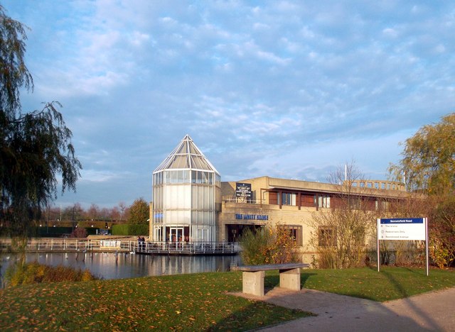
Image: © Des Blenkinsopp Taken: 10 Nov 2011
A waterside bar opened in 2004 by the Wetherspoons pub company. Most of the pub is in the next square, but the glass turret is just about in this one. The name has no American connection but remembers an old pub that was here years ago. The following is taken from Wetherspoons website, so thanks to them. Stockley Park was once an area used for brick-making and gravel extraction. Brick-making was thirsty work. However, refreshment was available at the long-standing, but now demolished, beer house known as The White House. Until 1912, The Stockley Park area was known as Starveall. The change of name was initiated by Broad & Co, which owned a brickworks there. 'Stockley' came from the well-known Cowley stocks, or bricks, produced there.
Images are licensed for reuse under creativecommons.org/licenses/by-sa/2.0
Image Location


Leaflet Map data © OpenStreetMap
Latitude
51.512126
Longitude
-0.445216