The Cranloch Burn
Introduction
The photograph on this page of The Cranloch Burn by Lairich Rig as part of the Geograph project.
The Geograph project started in 2005 with the aim of publishing, organising and preserving representative images for every square kilometre of Great Britain, Ireland and the Isle of Man.

There are currently over 7.5m images from over 14,400 individuals and you can help contribute to the project by visiting https://www.geograph.org.uk
The Cranloch Burn
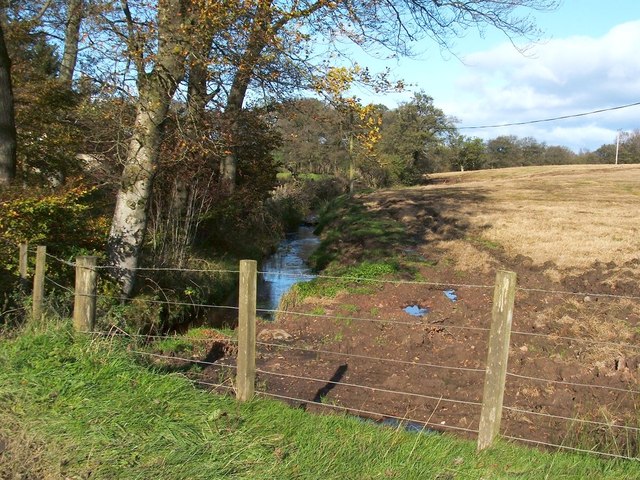
Image: © Lairich Rig Taken: 19 Oct 2011
The photograph was taken from the road; the picture Image was taken from about the same point. Cranloch is the name of a nearby house. The Cranloch Burn flows from Caldarvan Loch (Image), and joins with others to form the Carrochan Burn. Caldarvan Loch itself is the "L. Breeck" that is shown on the Pont/Blaeu map of the Lennox (surveyed 1580s-90s), and which is called "Loch Breach" in Roy's Military Survey of Scotland (1740s-50s). On the day I took this photograph, I was told that, despite the name on the map, local residents do not call the body of water "Caldarvan Loch". When surveying was being carried out for the first-edition OS map (c.1860), the loch was apparently known as Lochend (a name that is still applied to the buildings on its southern side). However, the OS Name Books record what appears to have been a quite peremptory request on the part of the "proprietor" (who was Mr R.D.Mackenzie of Image). The relevant entry in the OS Object Name Book is as follows: "Caldarvan Loch (other names: Lochend) – The proprietor wishes this loch to be in future called by the name supplied. That by which [it] is popularly known is Lochend." He may have had his way as far as the OS map goes, but local residents have a longer memory. This was not the only feature whose name Mr Mackenzie wished to change; it was also at his request that Kilmaronock Station (named after the parish in which it is located) was renamed Image
Images are licensed for reuse under creativecommons.org/licenses/by-sa/2.0
Image Location
Latitude
56.015801
Longitude
-4.535084