Conflicting information on the A6 at Dove Holes
Introduction
The photograph on this page of Conflicting information on the A6 at Dove Holes by M J Richardson as part of the Geograph project.
The Geograph project started in 2005 with the aim of publishing, organising and preserving representative images for every square kilometre of Great Britain, Ireland and the Isle of Man.

There are currently over 7.5m images from over 14,400 individuals and you can help contribute to the project by visiting https://www.geograph.org.uk
Conflicting information on the A6 at Dove Holes
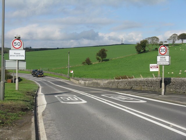
Image: © M J Richardson Taken: 13 Oct 2011
I wonder how long the RH sign has been like this/how long it will remain so? Photographic evidence for anybody nicked for going south through Dove Holes at 30+ mph?
Images are licensed for reuse under creativecommons.org/licenses/by-sa/2.0
Image Location
Latitude
53.306358
Longitude
-1.884558