Vicars Hill, Lewisham (2)
Introduction
The photograph on this page of Vicars Hill, Lewisham (2) by Stephen Craven as part of the Geograph project.
The Geograph project started in 2005 with the aim of publishing, organising and preserving representative images for every square kilometre of Great Britain, Ireland and the Isle of Man.

There are currently over 7.5m images from over 14,400 individuals and you can help contribute to the project by visiting https://www.geograph.org.uk
Vicars Hill, Lewisham (2)
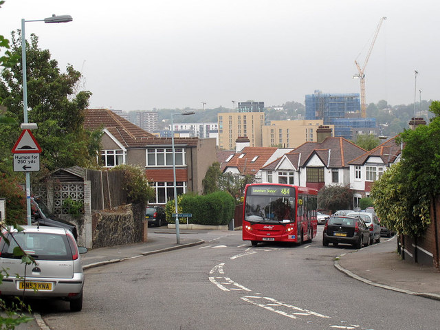
Image: © Stephen Craven Taken: 13 Oct 2011
Vicars Hill runs along the east side of Hilly Fields. This is the view north-east from the highest point on the road, towards Lewisham town centre. The bus is on route 484, from Camberwell Green to Lewisham.
Images are licensed for reuse under creativecommons.org/licenses/by-sa/2.0
Image Location
Latitude
51.460425
Longitude
-0.021739