Dumbarton, River Leven and River Clyde from the air
Introduction
The photograph on this page of Dumbarton, River Leven and River Clyde from the air by Thomas Nugent as part of the Geograph project.
The Geograph project started in 2005 with the aim of publishing, organising and preserving representative images for every square kilometre of Great Britain, Ireland and the Isle of Man.

There are currently over 7.5m images from over 14,400 individuals and you can help contribute to the project by visiting https://www.geograph.org.uk
Dumbarton, River Leven and River Clyde from the air
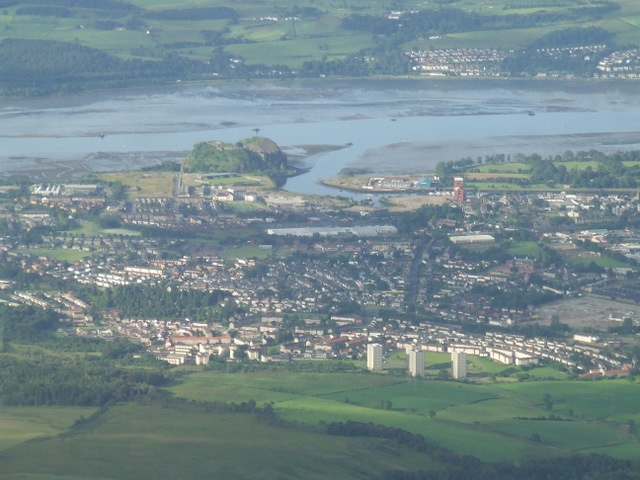
Image: © Thomas Nugent Taken: 15 Jul 2011
Looking over the Bellsmyre tower blocks to Bonhill Road, Dumbarton Rock and the rivers Clyde and Leven. Langbank is visible on the south bank of the Clyde. Viewed from a Glasgow bound flight from Newark, USA.
Images are licensed for reuse under creativecommons.org/licenses/by-sa/2.0
Image Location
Latitude
55.954965
Longitude
-4.556256