Stanmore: The Church House
Introduction
The photograph on this page of Stanmore: The Church House by Nigel Cox as part of the Geograph project.
The Geograph project started in 2005 with the aim of publishing, organising and preserving representative images for every square kilometre of Great Britain, Ireland and the Isle of Man.

There are currently over 7.5m images from over 14,400 individuals and you can help contribute to the project by visiting https://www.geograph.org.uk
Stanmore: The Church House
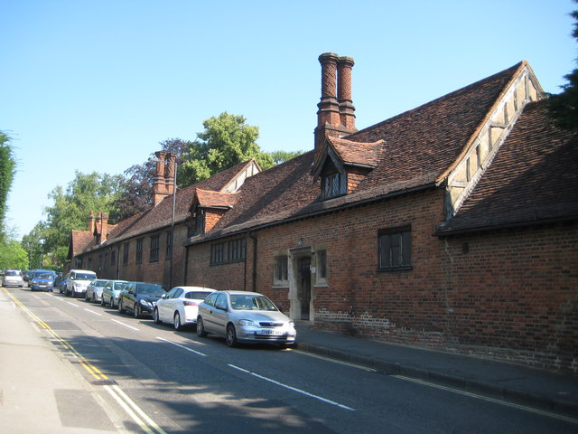
Image: © Nigel Cox Taken: 3 Jul 2011
The Church House along with Cowmans Cottage and Church Cottage form a group of listed buildings on the east side of Old Church Lane. Dating in part from the 16th century and with some fine decorative moulded brick chimneys, the block was reconstructed between 1925 and 1930. The road was always known as Old Church Lane, although when Stanmore briefly had a railway station on the national network it was known as Station Road.
Images are licensed for reuse under creativecommons.org/licenses/by-sa/2.0
Image Location
Latitude
51.615523
Longitude
-0.314001