Interlaced roads and rails
Introduction
The photograph on this page of Interlaced roads and rails by Robin Webster as part of the Geograph project.
The Geograph project started in 2005 with the aim of publishing, organising and preserving representative images for every square kilometre of Great Britain, Ireland and the Isle of Man.

There are currently over 7.5m images from over 14,400 individuals and you can help contribute to the project by visiting https://www.geograph.org.uk
Interlaced roads and rails
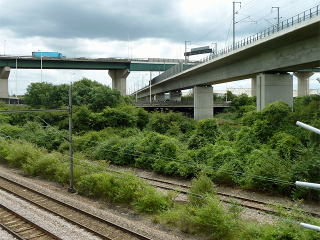
Image: © Robin Webster Taken: 19 Jun 2011
In the foreground are the tracks of the London, Tilbury and Southend line, whose passenger services are operated by c2c. Top right is the Channel Tunnel Rail Link, ramping down to pass under the Thames. It threads through the two levels of the A282, the road which breaks the continuity of the M25 to cross the Thames. The upper level over the bridge is usually southbound, the lower level through the tunnels usually northbound. There is a certain amount of hostility this side of the river to the name 'Dartford Crossing'.
Images are licensed for reuse under creativecommons.org/licenses/by-sa/2.0
Image Location
Latitude
51.474017
Longitude
0.265701