The M8 from the air
Introduction
The photograph on this page of The M8 from the air by Thomas Nugent as part of the Geograph project.
The Geograph project started in 2005 with the aim of publishing, organising and preserving representative images for every square kilometre of Great Britain, Ireland and the Isle of Man.

There are currently over 7.5m images from over 14,400 individuals and you can help contribute to the project by visiting https://www.geograph.org.uk
The M8 from the air
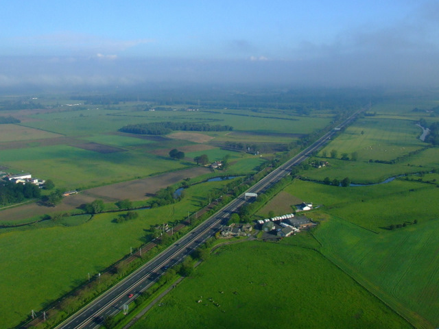
Image: © Thomas Nugent Taken: 12 Jun 2011
Black Cart Water can be seen passing under the motorway at Blackstoun Farm. The River Gryfe can be seen to the top right, just before it meets the Black Cart. The former Royal Ordnance Factory at Bishopton is hidden by the low cloud. The Glasgow to Gourock & Wemyss Bay railway line runs parallel to the motorway at this point.
Images are licensed for reuse under creativecommons.org/licenses/by-sa/2.0
Image Location
Latitude
55.865052
Longitude
-4.460837