Chalfont St Peter: Old Shire Lane
Introduction
The photograph on this page of Chalfont St Peter: Old Shire Lane by Nigel Cox as part of the Geograph project.
The Geograph project started in 2005 with the aim of publishing, organising and preserving representative images for every square kilometre of Great Britain, Ireland and the Isle of Man.

There are currently over 7.5m images from over 14,400 individuals and you can help contribute to the project by visiting https://www.geograph.org.uk
Chalfont St Peter: Old Shire Lane
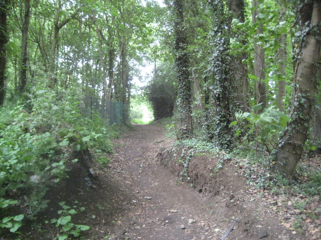
Image: © Nigel Cox Taken: 22 May 2011
This is the view looking north along Old Shire Lane which forms the county boundary between Hertfordshire to the right and Buckinghamshire to the left. The woodlands on either side of the lane are two of the Five Plantations. Unlike Image Old Shire Lane through here is not a driveable asphalted road, but is marked on the Ordnance Survey 1:25,000 scale maps with green diamonds indicating a "Recreational Route".
Images are licensed for reuse under creativecommons.org/licenses/by-sa/2.0
Image Location
Latitude
51.630625
Longitude
-0.534795