
Bournemouth: the bottom of Durley Chine
Introduction
The photograph on this page of Bournemouth: the bottom of Durley Chine by Chris Downer as part of the Geograph project.
The Geograph project started in 2005 with the aim of publishing, organising and preserving representative images for every square kilometre of Great Britain, Ireland and the Isle of Man.

There are currently over 7.5m images from over 14,400 individuals and you can help contribute to the project by visiting https://www.geograph.org.uk
Bournemouth: the bottom of Durley Chine
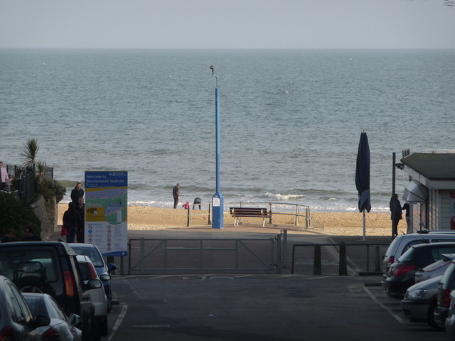
Image: © Chris Downer Taken: 3 Apr 2011
Heading west from Bournemouth town, this is the first of several chines, narrow tree-lined ravines, within a mile or so. This one also doubles up as a public car park while the rest are all in their natural state with a paved path through them. The steepness of the cliffs can be gleaned to an extent even though they are out of shot, because of the fact that the whole chine is in shade this late in the evening (6:30ish) while the beach will continue to bask in the sunlight for another twenty minutes or so.
Images are licensed for reuse under creativecommons.org/licenses/by-sa/2.0
Image Location

Latitude
50.713449
Longitude
-1.889329