Able's Acre and Victory Hall
Introduction
The photograph on this page of Able's Acre and Victory Hall by David Anstiss as part of the Geograph project.
The Geograph project started in 2005 with the aim of publishing, organising and preserving representative images for every square kilometre of Great Britain, Ireland and the Isle of Man.

There are currently over 7.5m images from over 14,400 individuals and you can help contribute to the project by visiting https://www.geograph.org.uk
Able's Acre and Victory Hall
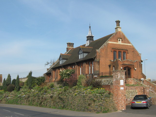
Image: © David Anstiss Taken: 12 Mar 2011
This rockery is on Forbes Road. It is seen by most visitors coming into Faversham. It is maintained by a Friends of Able's Acre Group. The Friends group was established in 2003 to ensure the continued well-being of the Forbes Road rockery, which in the 1960s was under the care of Walter Abel, parks superintendent of the former Faversham Borough Council, from whose surname its "Abel's Acre" nickname arose. See http://www.faversham.org/pages/directory_item.aspx?i_PageID=112293 for more details about the friends. Victory Hall at the top of the rockery is a converted church hall, currently used by a design company.
Images are licensed for reuse under creativecommons.org/licenses/by-sa/2.0
Image Location
Latitude
51.312557
Longitude
0.888156