Clumpfield Plantation at Marley Head
Introduction
The photograph on this page of Clumpfield Plantation at Marley Head by Adrian Platt as part of the Geograph project.
The Geograph project started in 2005 with the aim of publishing, organising and preserving representative images for every square kilometre of Great Britain, Ireland and the Isle of Man.

There are currently over 7.5m images from over 14,400 individuals and you can help contribute to the project by visiting https://www.geograph.org.uk
Clumpfield Plantation at Marley Head
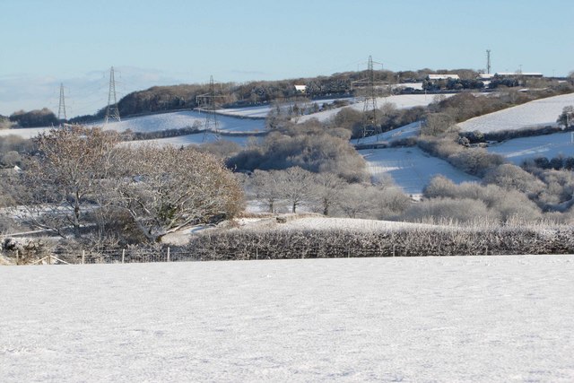
Image: © Adrian Platt Taken: 18 Dec 2010
Taken from Kerries Road in South Brent. The farm at the top right is Marley Thatch, with a mobile phone mast situated behind it, on what is one of the higher points locally that is not within the Dartmoor National Park where such masts are rarely approved. Also visible is the line of electricity pylons that follow the line of the A38 dual carriageway between Marley Head and Ivybridge. The A38 is out of sight here in the valley in front of the pylons and could not be heard this day as there was so little traffic, although its presence is usually given away by the constant background roar of traffic.
Images are licensed for reuse under creativecommons.org/licenses/by-sa/2.0
Image Location
Latitude
50.428067
Longitude
-3.798968