Former Hanbury Arms pub, Pontypool
Introduction
The photograph on this page of Former Hanbury Arms pub, Pontypool by Jaggery as part of the Geograph project.
The Geograph project started in 2005 with the aim of publishing, organising and preserving representative images for every square kilometre of Great Britain, Ireland and the Isle of Man.

There are currently over 7.5m images from over 14,400 individuals and you can help contribute to the project by visiting https://www.geograph.org.uk
Former Hanbury Arms pub, Pontypool
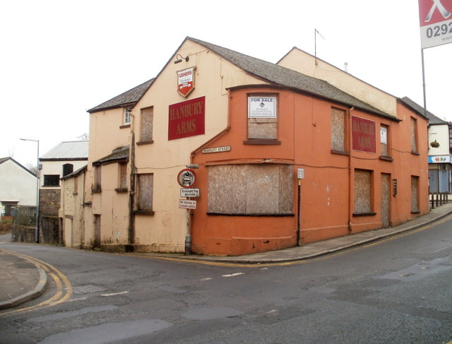
Image: © Jaggery Taken: 26 Jan 2011
Boarded-up former pub on the corner of Clarence Street and Trosnant Street viewed in January 2011. UPDATE February 2013. The pub has been renovated http://www.geograph.org.uk/photo/3328564 and is now the home of Pontypool Rugby Football Club.
Images are licensed for reuse under creativecommons.org/licenses/by-sa/2.0
Image Location
Latitude
51.699545
Longitude
-3.038871