Danvers Road
Introduction
The photograph on this page of Danvers Road by Martin Addison as part of the Geograph project.
The Geograph project started in 2005 with the aim of publishing, organising and preserving representative images for every square kilometre of Great Britain, Ireland and the Isle of Man.

There are currently over 7.5m images from over 14,400 individuals and you can help contribute to the project by visiting https://www.geograph.org.uk
Danvers Road
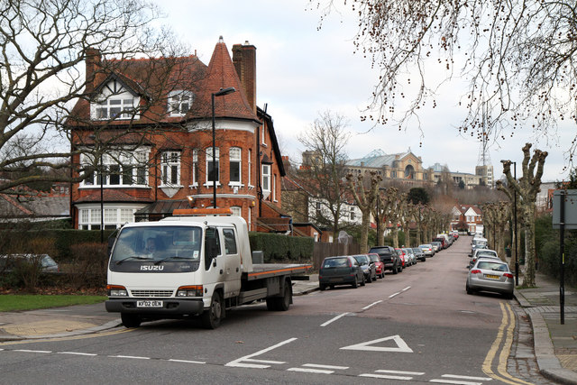
Image: © Martin Addison Taken: 28 Jan 2011
Seen from the junction with Priory Road. Alexandra Palace stands on the horizon looking down on the surrounding streets. Danvers Road is lined with pollarded Plane trees in common with many north London streets.
Images are licensed for reuse under creativecommons.org/licenses/by-sa/2.0
Image Location
Latitude
51.587294
Longitude
-0.130418