Disused railway incline at Bedlam
Introduction
The photograph on this page of Disused railway incline at Bedlam by Trevor Rickard as part of the Geograph project.
The Geograph project started in 2005 with the aim of publishing, organising and preserving representative images for every square kilometre of Great Britain, Ireland and the Isle of Man.

There are currently over 7.5m images from over 14,400 individuals and you can help contribute to the project by visiting https://www.geograph.org.uk
Disused railway incline at Bedlam
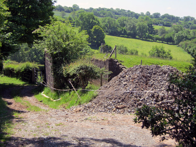
Image: © Trevor Rickard Taken: 16 Jun 2010
These abutments once held part of the mile-long Bitterley Incline, one of a pair of cable-railway inclines used for transporting stone from the Clee Hill quarries down to the railhead at Bitterley. The embankment of the steep incline can be seen on the right.
Images are licensed for reuse under creativecommons.org/licenses/by-sa/2.0
Image Location
Latitude
52.391866
Longitude
-2.611995