Harnham
Introduction
The photograph on this page of Harnham by Les Hull as part of the Geograph project.
The Geograph project started in 2005 with the aim of publishing, organising and preserving representative images for every square kilometre of Great Britain, Ireland and the Isle of Man.

There are currently over 7.5m images from over 14,400 individuals and you can help contribute to the project by visiting https://www.geograph.org.uk
Harnham
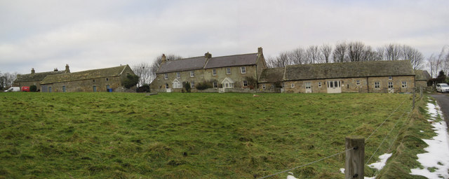
Image: © Les Hull Taken: 15 Dec 2010
The single storey building on the right are now a Buddhist Monestery http://www.ratanagiri.org.uk/ Originally they were "Byre and barn to East of No. 2, Harnham " These agricultural buildings date to the 18th century; a lintel bears the initials T.L. and the date 1786. The letters refer to a member of the Leighton family - this family owned the area from 1702. This is a Grade II Listed Building protected by law. http://www.keystothepast.info/durhamcc/K2P.nsf/K2PDetail?readform&PRN=N21048
Images are licensed for reuse under creativecommons.org/licenses/by-sa/2.0
Image Location
Latitude
55.118656
Longitude
-1.88489