Llwybr troed Cilhengroes-isaf / Cilhengroes-isaf footpath
Introduction
The photograph on this page of Llwybr troed Cilhengroes-isaf / Cilhengroes-isaf footpath by Alan Richards as part of the Geograph project.
The Geograph project started in 2005 with the aim of publishing, organising and preserving representative images for every square kilometre of Great Britain, Ireland and the Isle of Man.

There are currently over 7.5m images from over 14,400 individuals and you can help contribute to the project by visiting https://www.geograph.org.uk
Llwybr troed Cilhengroes-isaf / Cilhengroes-isaf footpath
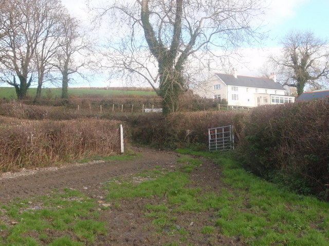
Image: © Alan Richards Taken: 10 Nov 2010
Llwybr cyhoeddus sy'n arwain o Ryd Henllan at Ffarm Cilhengroes Isa. Yn ol y Map OS o'r bedwaredd ganrif ar bymtheg heol oedd hon a arweinai at Henllan Amgoed o gyfeiriad Llanboidy. Bellach, fe'i hisraddwyd i lwybr cyhoeddus ac oherwydd blynyddau o esgeulustod mae angen gwaith cynnal a chadw arni. Y ty yn y pellter yw Lle Bach. A public footpath leading from Rhyd Henllan to Cilhengroes Isaf Farm. According to the OS Map dating from the nineteenth century this was one of the main roads to Henllan Amgoed. Today it has been downgraded to a footpath and after years of neglect it is badly in need of maintenance work. The property in the photo is Lle Bach.
Images are licensed for reuse under creativecommons.org/licenses/by-sa/2.0
Image Location
Latitude
51.861279
Longitude
-4.626776