Castle View Terrace
Introduction
The photograph on this page of Castle View Terrace by Ian Capper as part of the Geograph project.
The Geograph project started in 2005 with the aim of publishing, organising and preserving representative images for every square kilometre of Great Britain, Ireland and the Isle of Man.

There are currently over 7.5m images from over 14,400 individuals and you can help contribute to the project by visiting https://www.geograph.org.uk
Castle View Terrace
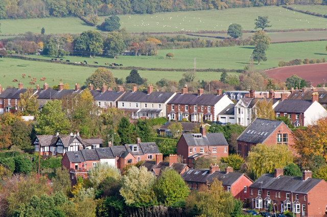
Image: © Ian Capper Taken: 30 Oct 2010
Castle View Terrace (the line of houses across the centre of the photo) was built in the 1870s on high land looking towards Ludlow Castle (as its name suggests) and Bringewood, as part of the Victorian development of this area of Ludlow. Running up from the bottom left of the photo is New Road, including the former Zion Chapel, built in 1878. In the bottom right hand corner is Bellevue Terrace (originally called Chapel Fields). The row of houses in New Road along with those in Bellevue Terrace date from the early 1880s. Viewed from the tower of St Laurence's Church.
Images are licensed for reuse under creativecommons.org/licenses/by-sa/2.0
Image Location
Latitude
52.374977
Longitude
-2.715395