Buckingham: The Woolpack Bridge
Introduction
The photograph on this page of Buckingham: The Woolpack Bridge by Nigel Cox as part of the Geograph project.
The Geograph project started in 2005 with the aim of publishing, organising and preserving representative images for every square kilometre of Great Britain, Ireland and the Isle of Man.

There are currently over 7.5m images from over 14,400 individuals and you can help contribute to the project by visiting https://www.geograph.org.uk
Buckingham: The Woolpack Bridge
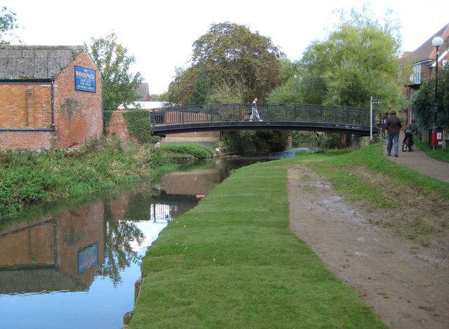
Image: © Nigel Cox Taken: 17 Oct 2010
The current bridge dates from 1988 and replaced an earlier six arch stone bridge over the River Great Ouse. Image is just beyond the bridge, while the outbuildings of The Woolpack public house are visible left. The pedestrian route along the river is known as the Chris Nicholls Walk. Returfing and reseeding of the river bank has evidently recently taken place.
Images are licensed for reuse under creativecommons.org/licenses/by-sa/2.0
Image Location
Latitude
51.998018
Longitude
-0.987205