Padbury: The Church of St Mary the Virgin
Introduction
The photograph on this page of Padbury: The Church of St Mary the Virgin by Nigel Cox as part of the Geograph project.
The Geograph project started in 2005 with the aim of publishing, organising and preserving representative images for every square kilometre of Great Britain, Ireland and the Isle of Man.

There are currently over 7.5m images from over 14,400 individuals and you can help contribute to the project by visiting https://www.geograph.org.uk
Padbury: The Church of St Mary the Virgin
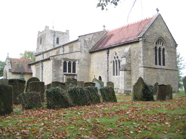
Image: © Nigel Cox Taken: 17 Oct 2010
This is a repeat of Rob's Image from more or less the same angle but on a somewhat gloomier day. The naming of this church seems to have a curious history. Old Ordnance Survey maps of the Victorian era and up to 1923 call it St Matthew's, yet the 1927 History of the County of Buckingham refers to it as The Church of The Nativity of The Blessed Virgin. By 1977 the Ordnance Survey are calling it St Mary's Church, but by 1983 they had retired from the fray and called it just PW (Place of Worship).
Images are licensed for reuse under creativecommons.org/licenses/by-sa/2.0
Image Location
Latitude
51.971988
Longitude
-0.951252