Folkestone Warren from the North Downs Way
Introduction
The photograph on this page of Folkestone Warren from the North Downs Way by Marathon as part of the Geograph project.
The Geograph project started in 2005 with the aim of publishing, organising and preserving representative images for every square kilometre of Great Britain, Ireland and the Isle of Man.

There are currently over 7.5m images from over 14,400 individuals and you can help contribute to the project by visiting https://www.geograph.org.uk
Folkestone Warren from the North Downs Way
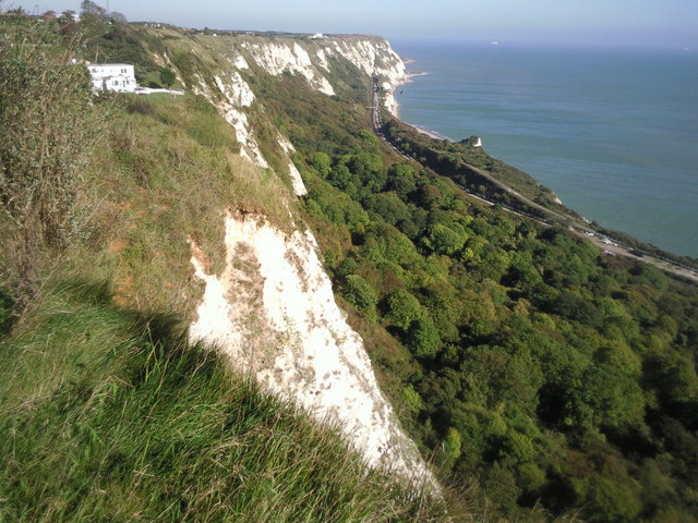
Image: © Marathon Taken: 11 Oct 2010
Taken from near the Battle of Britain Memorial at Capel-le-Ferne, the steep cliffs dropping down to the wooded Folkestone Warren can be seen. The railway line from Folkestone to Dover can also be clearly seen as it follows the coast to disappear into Abbotscliff Tunnel.
Images are licensed for reuse under creativecommons.org/licenses/by-sa/2.0
Image Location
Latitude
51.098692
Longitude
1.211221