St George's church in Wyverstone
Introduction
The photograph on this page of St George's church in Wyverstone by Evelyn Simak as part of the Geograph project.
The Geograph project started in 2005 with the aim of publishing, organising and preserving representative images for every square kilometre of Great Britain, Ireland and the Isle of Man.

There are currently over 7.5m images from over 14,400 individuals and you can help contribute to the project by visiting https://www.geograph.org.uk
St George's church in Wyverstone
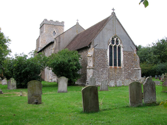
Image: © Evelyn Simak Taken: 18 Sep 2010
St George's church > http://www.geograph.org.uk/photo/2074007 has a wooden porch > http://www.geograph.org.uk/photo/2074010 that dates from the 15th century. Inside there are a C15 font and a C16 linen fold panelled pulpit > http://www.geograph.org.uk/photo/2074027 the door of which has been incorporated into the remaining lower part of the chancel screen > http://www.geograph.org.uk/photo/2074025 at some time in the past. The benches date from the 17th century, some have carved ends and one is inscribed with initials > http://www.geograph.org.uk/photo/2074040. Medieval glass > http://www.geograph.org.uk/photo/2074049 can be seen in the tracery lights of two nave windows. The most notable feature of the church is the 16th century chancel screen > http://www.geograph.org.uk/photo/2074016. Only the panels remain, however, they are not painted but have subjects carved into them > http://www.geograph.org.uk/photo/2074020 in relief, a very rare if not unique feature. An interesting gravestone > http://www.geograph.org.uk/photo/2074064 can be found in the churchyard. It is situated to the north-west of the church and marks the grave of Robert Nicholas Sanderson, a member of the Order of the Temple (Knights Templar), who died in 1896 and was rector here from 1882 - 1896.
Images are licensed for reuse under creativecommons.org/licenses/by-sa/2.0
Image Location
Latitude
52.270956
Longitude
0.991564