The Thames Path east of Cross Ness
Introduction
The photograph on this page of The Thames Path east of Cross Ness by Marathon as part of the Geograph project.
The Geograph project started in 2005 with the aim of publishing, organising and preserving representative images for every square kilometre of Great Britain, Ireland and the Isle of Man.

There are currently over 7.5m images from over 14,400 individuals and you can help contribute to the project by visiting https://www.geograph.org.uk
The Thames Path east of Cross Ness
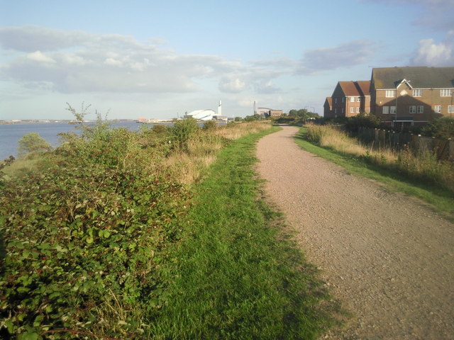
Image: © Marathon Taken: 30 Aug 2010
The Thames Path here is high up on a flood embankment which protects the low lying Thamesmead on the other side from the river. The white building in the distance is the new Belvedere Refuse Incinerator whilst to its right, looking like a mirror reflection, is The Sludge Incinerator at Crossness Sewage Treatment Works.
Images are licensed for reuse under creativecommons.org/licenses/by-sa/2.0
Image Location
Latitude
51.512697
Longitude
0.130845