Lynton & Lynmouth Station (converted)
Introduction
The photograph on this page of Lynton & Lynmouth Station (converted) by Ben Brooksbank as part of the Geograph project.
The Geograph project started in 2005 with the aim of publishing, organising and preserving representative images for every square kilometre of Great Britain, Ireland and the Isle of Man.

There are currently over 7.5m images from over 14,400 individuals and you can help contribute to the project by visiting https://www.geograph.org.uk
Lynton & Lynmouth Station (converted)
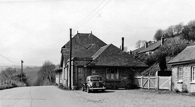
Image: © Ben Brooksbank Taken: 25 Apr 1960
View SW, towards Barnstaple. The ex-Southern Railway Lynton & Barnstaple narrow-gauge line had been closed completely on 29/9/35 and when photographed in 1960 this station (some way short of Lynton) was a private house. The Lynton & Barnstaple Railway Association/Company acquired Woody Bay Station in 2000 and by 2006 had restored a mile of the line from there to Killington Lane, with plans to return to Lynton eventually.
Images are licensed for reuse under creativecommons.org/licenses/by-sa/2.0
Image Location
Latitude
51.222899
Longitude
-3.835776