Drayton Park Station
Introduction
The photograph on this page of Drayton Park Station by Dr Neil Clifton as part of the Geograph project.
The Geograph project started in 2005 with the aim of publishing, organising and preserving representative images for every square kilometre of Great Britain, Ireland and the Isle of Man.

There are currently over 7.5m images from over 14,400 individuals and you can help contribute to the project by visiting https://www.geograph.org.uk
Drayton Park Station
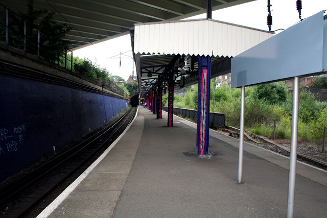
Image: © Dr Neil Clifton Taken: 30 Jun 2010
Looking south. The map gives the misleading impression that the tunnel mouth seen leads to an exit onto the North London Line in an easterly direction. This is quite false, as the tunnels do not emerge anywhere - they continue to a terminus at Moorgate which is entirely underground.
Images are licensed for reuse under creativecommons.org/licenses/by-sa/2.0
Image Location
Latitude
51.553077
Longitude
-0.105136